
In the vast and varied landscape of Texas, land surveyors play an indispensable role in the development, transaction, and management of land. Their meticulous work ensures that property lines are accurately defined, land features are precisely mapped, and construction projects are carried out with exactitude. The following article delves into the critical functions of land survey firms and the diverse types of surveys available to Texas landowners, highlighting their importance in facilitating successful land projects.
Key Takeaways
- Land survey firms in Texas are crucial for accurate property transactions, boundary confirmations, and supporting complex land developments.
- A range of land surveys are available in Texas, including boundary, topographic, construction, and specialized surveys, each serving a specific purpose.
- Licensed Texas land surveyors are equipped to assist landowners with any survey type, ensuring precision and adherence to legal standards.
The Critical Role of Land Survey Firms in Texas Land Projects
Facilitating Property Transactions and Boundary Confirmations
When you’re involved in commercial land transactions in Texas, understanding and confirming property boundaries is paramount. Land survey firms play a pivotal role in ensuring that your property transactions are seamless and legally sound. They provide detailed, researched reports that confirm the absence of trespassing or boundary conflicts, adherence to all zoning and building laws, and the accessibility of all easements.
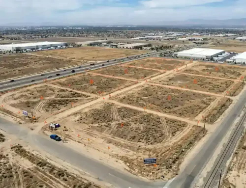
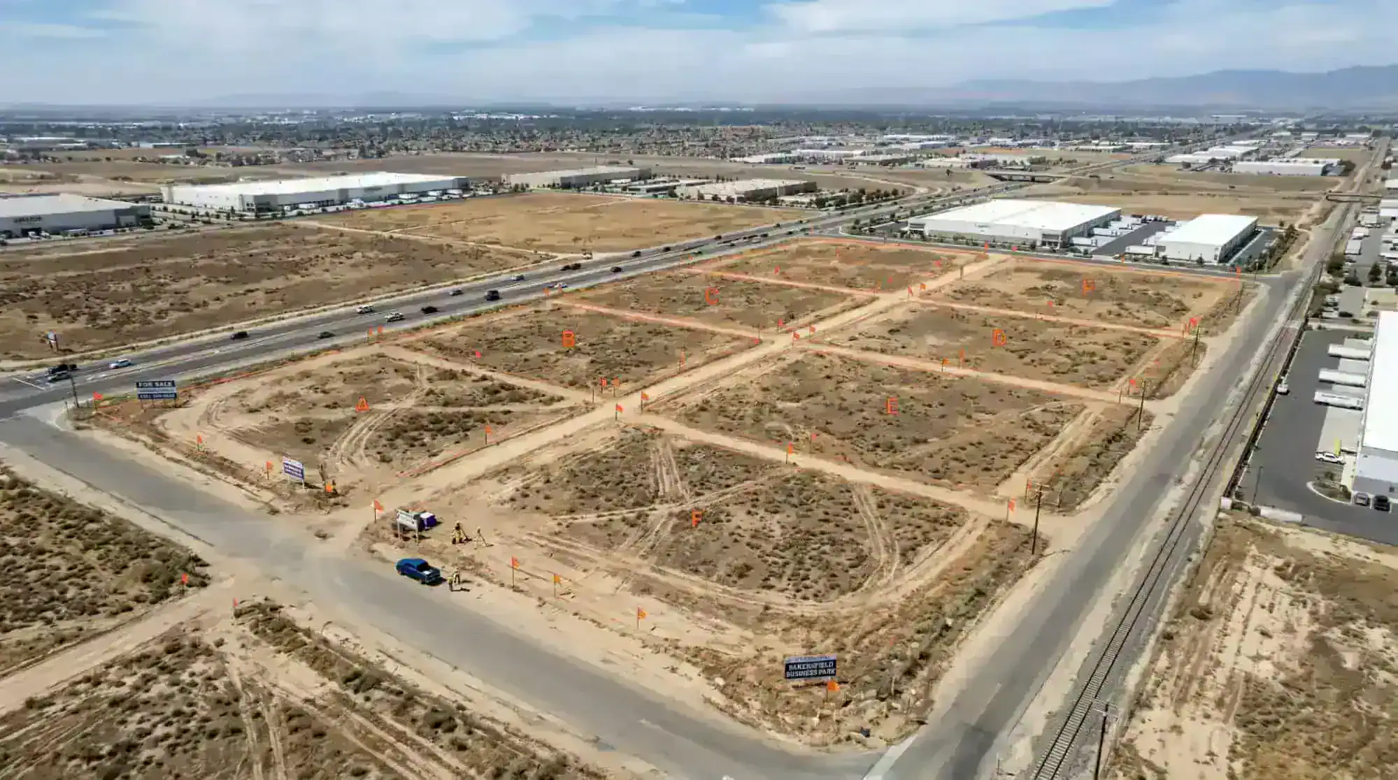
Drone surveys have revolutionized the way land surveyors in Texas operate, offering a bird’s-eye view to accurately map out land for commercial use. Here’s how a land survey can facilitate your next transaction:
- Confirming property lines for building purposes or to resolve disputes.
- Ensuring compliance with the Texas Property Code, particularly Section 41.001, which limits encumbrances on homestead property.
- Providing title surveys as part of the real estate sales process, a prerequisite for financing and title insurance.
Whether you’re buying, selling, or developing commercial property, a professional land surveyor is your ally in navigating the complexities of land ownership and development.
Supporting Complex Land Development with Expert Surveys
When you embark on a complex land development project in Texas, the expertise of a land survey firm becomes invaluable. Land survey services are instrumental in navigating the intricate web of commercial land usage and zoning regulations. With their assistance, you can confidently present your site plans to zoning and planning boards for approval, ensuring your project kicks off without a hitch.
Drone-assisted topography is revolutionizing the way land surveys are conducted, offering a bird’s-eye view that is both comprehensive and precise. This cutting-edge technology is particularly beneficial for:
- Mapping large-scale commercial sites
- Identifying potential issues with land features
- Providing detailed data for site planning
Remember, securing the right land survey services is not just about meeting legal requirements; it’s about verifying the past to secure your future. Whether you’re expanding a business, establishing new operations, or simply ensuring the precision of your property lines, a licensed Texas surveyor with expertise in drone surveys will guide you through the process with precision and care.
Related: Does a Buyer or Seller Pay For a Land Survey?
Ensuring Precision and Legal Compliance in Land Documentation
In the realm of commercial land usage and development, the expertise of Texas surveyors is indispensable. These professionals are tasked with the critical responsibility of ensuring that every inch of your project adheres to the stringent zoning regulations and legal standards that govern land use in Texas. Their precision in land documentation is not just a matter of accuracy, but of legal necessity.
- Title surveys are a fundamental requirement for real estate transactions, securing financing, and obtaining title insurance.
- Detailed survey reports confirm the absence of boundary conflicts, adherence to zoning and building laws, and the accessibility of easements.
Moreover, with the advent of drone survey technology, surveyors can now provide even more detailed and comprehensive data, facilitating informed decision-making for your commercial projects. Establish your property’s legal boundaries with precision and ensure your project’s success by relying on the meticulous work of licensed surveyors.
Understanding the Spectrum of Texas Land Surveys

Boundary Surveys: Defining Property Lines and Perimeters
When you’re embarking on a commercial land project in Texas, understanding the precise boundaries of your property is paramount. Land surveyors measure and map land boundaries accurately using physical landmarks. These surveys are crucial for a multitude of reasons:
- They facilitate the resolution of boundary disputes.
- They confirm property ownership, which is essential for zoning and development purposes.
- They ensure that any construction or improvements are within legal limits.
Property line surveys are not just a formality; they are a necessity for buyers and owners to protect investments and ensure legal compliance. Especially in commercial ventures, where the stakes are high, having a clear demarcation of your land can save you from future legal entanglements and financial losses. Moreover, with the advent of drone technology, surveyors can now provide more detailed and comprehensive data, making it easier for you to plan and execute your projects with confidence.
Related: How Long Is a Land Survey Good for?
Topographic Surveys: Mapping Land Features and Elevations
When you’re embarking on a commercial land development project in Texas, understanding the lay of the land is not just beneficial—it’s imperative. Topographic surveys are the cornerstone of this understanding, providing a detailed map of the land’s features and elevations. These surveys are essential for several reasons:
- They help in identifying the best use of the land in accordance with zoning regulations.
- They are crucial for planning and designing construction projects, ensuring that the development aligns with the natural terrain.
- They assist in managing water runoff and drainage, which is vital for the sustainability of the property.
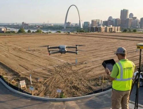
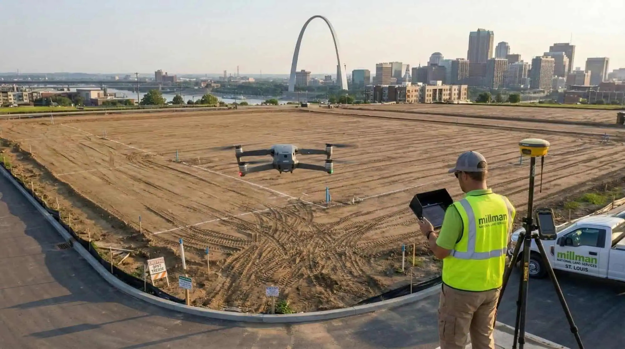
Our team at Millman National Land Services utilizes the latest in survey technology, including drone surveys, to deliver precise topographic data. This modern approach not only increases accuracy but also significantly reduces the time needed to conduct surveys, allowing for a more efficient project timeline. Whether you’re planning a commercial building, an industrial site, or a public amenity, our topographic surveys lay the groundwork for a successful development that respects the natural landscape and adheres to legal compliance. Remember, thorough site planning surveys, which combine topographical and boundary surveys, are indispensable for navigating the complexities of land development and avoiding potential disputes over property lines and usage rights.
Construction Surveys: Guiding Development with Precision
When embarking on commercial construction projects, the precision of a construction survey is paramount. These surveys document the placement of buildings, roads, utilities, and other land improvements, providing the necessary instruction for completing the project with accuracy. By using advanced techniques such as drone surveys, surveyors can capture comprehensive data from above, offering a bird’s-eye view that is invaluable for planning and monitoring progress.
Zoning regulations and commercial land usage policies are critical factors in the development process. A detailed construction survey helps ensure that your project adheres to these regulations, avoiding costly delays and legal issues. Here’s how you can leverage construction surveys for your project:
- Present your site plans to zoning and planning boards for approval.
- Use the survey data for precise site planning and to address topographical land features.
- Monitor construction progress to ensure it aligns with documented site plans.
Remember, consulting with professional surveyors who specialize in commercial land projects is essential. They can provide boundary, location, and ALTA/ACSM surveys to detail boundaries, locations, and land titles. For complex projects requiring topographic expertise, tools like theodolites, laser scanners, and GPS are employed. Always consult professionals for topographic surveys to secure the future of your development.
Related: A Primer on the ALTA/NSPS Land Title Survey, Table A
Specialized Surveys: Addressing Unique Landowner Needs
In the dynamic landscape of Texas real estate, specialized surveys are pivotal for commercial land usage and zoning. These tailored assessments are essential for making informed decisions about property development and utilization. As a landowner, you may find that standard surveys don’t always cover the specific needs of your project. That’s where specialized surveys come in, offering a range of services including:
- ALTA surveys for high-detail title insurance purposes
- Zoning reports to ensure compliance with local regulations
- Drone surveys for a comprehensive aerial perspective
With the advent of technology, drone surveys have become a game-changer, providing rapid, accurate data collection while minimizing risks and costs. Whether you’re looking to develop a new shopping center, expand an existing facility, or navigate the complexities of zoning laws, a specialized survey can provide the clarity and precision you need. Remember, the right surveying services can be the difference between a successful project and costly oversights.
Navigating the complex terrain of Texas land surveys can be a daunting task, but with our comprehensive services, you’ll have the expertise you need at your fingertips. From ALTA Land Surveying to Zoning Compliance Reports, we provide full-scale land services to meet your every need.
Don’t leave your property to chance; ensure precision and compliance with our nationwide team. Visit our website to learn more and place your order today for unparalleled land surveying solutions.
Conclusion

In the vast and varied landscape of Texas, land surveyors play a pivotal role in the development, sale, and management of property. From boundary surveys to detailed topographical mappings, these professionals provide the essential services needed to ensure accuracy and legal compliance in land transactions and projects. Whether you are a landowner seeking to resolve a boundary dispute, a developer embarking on a major construction project, or a commercial broker like George Owens who values precision and professionalism, engaging with a licensed Texas land surveyor is a critical step. With their expertise and attention to detail, surveyors like those at South Texas Surveying and Payne Industries are indispensable partners in paving the way for successful land endeavors. As we have seen, Texas offers a variety of land survey types to meet every need, and licensed surveyors are ready to assist with each one, ensuring that every project is built on a foundation of precise and reliable land documentation.


