Nashville’s commercial landscape is evolving fast. With major development projects reshaping the skyline and land parcels being rezoned for mixed-use properties, accurate surveying isn’t optional anymore. Whether you’re planning a retail complex, an industrial facility, or a multi-tenant office building, getting the measurements and boundaries right from day one can save you from costly delays, legal headaches, and construction errors.
Key Takeaways
- Commercial land surveying provides accurate measurements of property boundaries, easements, and zoning requirements critical for development projects.
- Drone surveys and aerial technology help capture precise site data faster than traditional methods, especially for large or complex parcels.
- Local surveyors understand Nashville’s unique zoning laws and regulatory environment, which can vary significantly across Davidson County.
- ALTA/NSPS surveys are the industry standard for commercial transactions and provide comprehensive detail for lenders and title companies.
- Choosing a surveyor with in-house licensed professionals ensures better quality control and faster turnaround than firms that rely on subcontractors.
Precision in Every Measurement
When you’re dealing with commercial real estate, the margin for error is zero. A misplaced boundary stake or an overlooked easement can derail an entire project before the first shovel hits dirt.
Accurate surveys identify property lines, topographic features, and potential encroachments that could affect construction or property value. In Nashville, where development is happening at breakneck speed, precision isn’t just about meeting standards, it’s about protecting your investment.
Land survey data forms the foundation of every major commercial transaction. Lenders need it, title companies require it, and developers depend on it to make informed decisions about site planning.
Specialized Commercial Land Surveying
Commercial land surveying goes way beyond staking out corners. It includes detailed analysis of zoning codes, setback requirements, flood zones, utility easements, and access rights. Each of these factors can impact how you use your property and what you can build on it.
ALTA/NSPS land title surveys are the gold standard for commercial properties. These surveys meet strict national criteria and provide comprehensive documentation that satisfies lenders, insurers, and legal teams. They’re especially important when buying a property because they reveal any issues that could affect ownership or development potential.
Understanding zoning laws in Nashville means navigating both citywide regulations and neighborhood-specific overlays. Some areas have height restrictions, others mandate certain parking ratios, and some prohibit specific commercial uses altogether. A qualified surveyor doesn’t just measure the land, they help you understand what you can actually do with it.
Areas of Expertise
Construction Staking
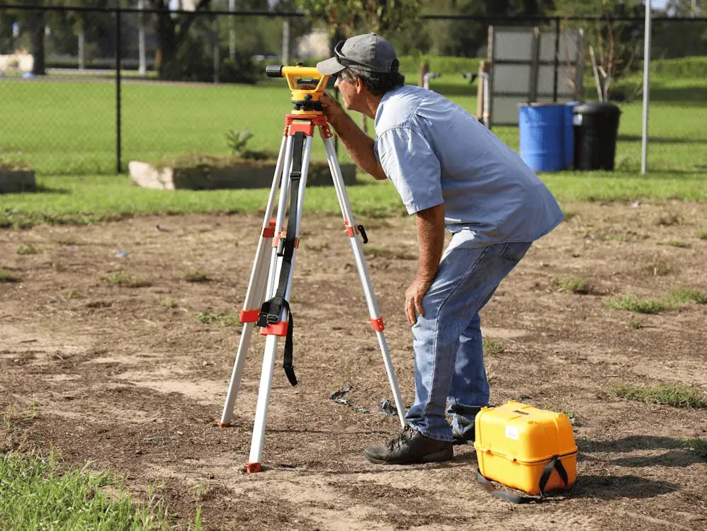
Construction staking translates architectural plans into physical markers on the ground. These stakes guide contractors during excavation, foundation work, and building layout, making sure everything gets built exactly where it’s supposed to be.
Boundary Surveys
A property line survey establishes the legal boundaries of a parcel based on deed research, historical records, and field measurements. It resolves disputes, prevents encroachments, and provides clarity when multiple properties share complex boundary configurations.
Topographic Surveys
Topographic surveys map the contours, elevations, and natural features of a site. They show slopes, drainage patterns, existing vegetation, and structures. Architects and civil engineers rely on topo surveys to plan grading, stormwater management, and building placement.
Land Mapping
Land mapping creates a visual representation of property features, easements, and rights-of-way. It’s useful for planning, marketing, and legal documentation. Good mapping helps stakeholders visualize site potential and identify constraints before investing capital.
Corner Records
Corner records document the location of property corners using precise coordinates and physical monuments. They’re filed with local authorities and serve as permanent reference points for future surveys.
As-Built Surveys
As-built surveys document what actually got built compared to the original design plans. They’re critical for final inspections, obtaining certificates of occupancy, and ensuring compliance with permits and zoning approvals.
Why Choose a Nashville Surveyor?
Local expertise matters. Nashville surveyors understand Davidson County’s permitting process, know which municipal offices to contact for record research, and have relationships with zoning officials. They’re familiar with the area’s geology, which affects everything from foundation design to floodplain mapping.
Working with licensed professionals who operate in-house rather than subcontracting work means better quality control, faster communication, and more accountability.
Proven Track Record
Experience in Nashville’s commercial market means understanding the unique challenges of surveying everything from repurposed industrial sites in the Gulch to greenfield developments in the suburbs. A proven track record shows up in on-time delivery, accurate documentation, and smooth coordination with project stakeholders.
Tailored Surveying Services
Precise Design Surveys
Design surveys provide the detailed information architects and engineers need to create site plans, building layouts, and infrastructure designs. They include boundary verification, topographic mapping, utility locations, and identification of any constraints that could affect design decisions.
Topographic Surveys for Planning
Planning-phase topo surveys give developers early insights into site feasibility. They reveal drainage issues, slope challenges, and existing conditions that could drive up construction costs. Getting this information upfront prevents surprises later when changes are more expensive.
Additional Services
Modern surveying goes beyond traditional ground-based methods. Drone surveys and aerial photography capture comprehensive site data quickly and safely, especially on large properties or sites with difficult terrain. Drones provide high-resolution imagery, 3D modeling capabilities, and volumetric calculations that would take days using conventional techniques.
Advanced GPS technology and laser scanning equipment improve accuracy and speed up fieldwork. These tools allow surveyors to collect massive amounts of data in less time, reducing project timelines without sacrificing quality.
Why We Stand Out in Nashville
Reliable service means showing up when you say you will and delivering what you promised. It means clear communication throughout the project and proactive problem-solving when challenges arise. Fast turnaround matters because commercial projects operate on tight schedules. A surveyor who understands urgency and has the resources to mobilize quickly keeps your project moving forward.
Frequently Asked Questions
What does a commercial land surveyor do?
A commercial land surveyor measures and maps property boundaries, topography, easements, and improvements. They prepare documentation for real estate transactions, support design and construction teams, verify zoning compliance, and resolve boundary disputes.
How long does a survey take in Nashville?
Timeline depends on property size, complexity, and the type of survey required. A straightforward boundary survey might take a few days, while a comprehensive ALTA survey on a multi-acre site could take several weeks.
What documents are needed before a survey?
You’ll typically need the property deed, legal description, title commitment or title insurance policy, and any existing surveys or plats. The more information you provide upfront, the more efficiently the surveyor can complete the work.
How much does a commercial survey cost?
Cost varies based on property size, survey type, site accessibility, and project complexity. Dense vegetation, difficult terrain, or properties with unclear title history add time and expense. Most surveyors provide quotes after reviewing property details.
Ready to Move Forward with Confidence?
Building in Nashville? Don’t leave your project’s foundation to chance. Accurate surveying protects your investment, keeps you compliant with local regulations, and gives you the data you need to make smart development decisions.
Get started with a consultation today and see how precision surveying can streamline your next commercial development project.


