Are you in need of professional land surveying services in Washington State? Look no further! At Millman National Land Services, we offer comprehensive surveying solutions tailored to meet the diverse needs of our clients.
Whether you’re planning a construction project, purchasing property, or need to resolve boundary disputes, our expert team is here to assist you with precision and care. Read on to learn more about what to expect from a Washington surveyor and why choosing Millman National Land Services is your best bet for reliability and expertise.
What to Look for in a Washington Surveyor
When selecting a land surveyor in Washington, it’s crucial to consider several key factors to ensure you receive the highest quality service. Firstly, check for proper licensing and certifications (Washington State Department of Licensing – Land Surveyor Licensing), as these are indicators of professional training and legitimacy. Experience in the field, particularly with projects similar to yours, is also vital. Additionally, look for a surveyor who utilizes the latest technology and methods (National Society of Professional Surveyors (NSPS), which contribute to accuracy and efficiency. Finally, choose someone who has a strong reputation for customer service and clear communication.
How Much Does a Washington Surveyor Cost?
The cost of land surveying services in Washington can vary widely depending on the type of survey required, the size and complexity of the land, and the specific details of the project. For basic boundary surveys, prices might start from a few hundred dollars, but more complex surveys involving topographic data or legal disputes can cost several thousand. To get a precise estimate, it’s best to contact us directly so we can evaluate your specific needs and provide a tailored quote.
What Do Washington Surveyors Do?
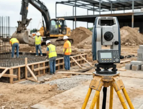
Washington surveyors perform a range of essential services that are crucial for accurate land assessment and development. These include boundary surveys to determine the exact limits of a property, topographic surveys to map the land’s contours and features, and ALTA/NSPS surveys for comprehensive title insurance purposes (American Land Title Association (ALTA)). Surveyors also play a critical role in construction (Washington State Building Code Council), providing the necessary data to ensure structures are built in the correct location and to specification. Additionally, they can assist with environmental conservation (Washington State Department of Natural Resources (DNR)) and zoning regulations compliance.
Why Choose Millman National Land Services?
Choosing Millman National Land Services means partnering with a leader in the field of land surveying. Our commitment to quality, customer satisfaction, and technological innovation sets us apart. We bring decades of experience across a variety of surveying projects, ensuring that no matter the challenge, we deliver precise and reliable results. Our team of dedicated professionals is here to guide you through every step of your surveying project, equipped with the expertise and tools necessary to meet your needs efficiently and effectively.
Frequently Asked Questions
1. What should I provide to get a survey quote?
To receive an accurate quote for surveying services, it’s helpful to provide detailed information about your property and the specific services you need. This includes the address and size of the property, the type of survey you require (e.g., boundary, topographic, ALTA/NSPS), and any specific concerns or issues you want addressed, such as boundary disputes or construction needs. Additional details, such as previous surveys and legal descriptions, can also aid in providing a more accurate estimate.
2. How long does a typical land survey take?
The duration of a land survey depends on the complexity and size of the property, as well as the type of survey being conducted. Simple boundary surveys on small residential lots might be completed in a few days, while larger, more complex surveys could take weeks. Factors such as weather, accessibility, and the current condition of any existing boundary evidence (like fences or markers) can also affect the timeline.
3. Can Millman surveyors help with property disputes?
Yes, Millman National Land Services specializes in handling property disputes with professionalism and precision. Our experienced surveyors can provide detailed surveys and clear documentation that can be crucial in legal disputes regarding property boundaries. We work closely with property owners and legal advisors to ensure that all data provided is accurate and legally compliant.
4. What technology do you use in surveying?
We employ a variety of advanced technologies in our surveying processes, including GPS systems, robotic total stations, and drones for aerial photography. These tools allow us to provide accurate, efficient, and comprehensive survey data, helping to reduce errors and improve the overall quality of the surveys we deliver.
5. Is there a best time of year to conduct land surveys?
While land surveys can be conducted year-round, weather conditions can impact the process. Ideal conditions are typically during the spring and summer months when visibility is high and the ground is accessible. However, we are equipped to handle surveys under various weather conditions throughout the year to meet our clients’ needs.
6. How do I know if I need a land survey?
You might need a land survey if you are buying, selling, or developing property, involved in a property dispute, or need to comply with local regulations. Surveys are also crucial when installing fences, constructing new buildings, or subdividing land. Consulting with a professional surveyor can help you determine the specific type of survey required for your situation.
7. What’s the difference between a boundary survey and a topographic survey?
A boundary survey is primarily focused on determining the exact boundaries of a property using historical records and physical markers. A topographic survey, on the other hand, maps the natural land features, such as trees, hills, buildings, and other improvements. This type of survey is often used in planning and development stages of property improvements.
8. Do you provide surveying services for both residential and commercial properties?
Yes, Millman National Land Services provides surveying services for both residential and commercial properties. Our wide range of services is designed to meet the diverse needs of all our clients, whether they are homeowners, real estate developers, or commercial property managers.
9. How often should I have my property surveyed?
The frequency of necessary surveys depends on the property’s usage and any changes it undergoes. For instance, after major constructions, modifications, or before new property developments, it’s wise to have a survey conducted. Regular surveys can also be important in areas prone to land disputes or where property boundaries may not be clear.
10. Can your surveys be used for legal purposes?
Absolutely, our surveys are conducted to meet legal standards and can be used in a variety of legal contexts, including property disputes, title transfers, and court cases. We ensure all legal requirements are met, providing reliable documentation for any necessary legal proceedings.
11. What if my survey results differ from previous surveys?
Differences between survey results can occur due to several factors, including changes in technology, methods, and even legal standards over time. In such cases, it’s important to analyze both surveys to understand the discrepancies and determine the most accurate and legally sound conclusion. Our team is equipped to handle such complexities and provide clarity.
12. Are land surveyors in Washington required to be licensed?
Yes, in Washington, as in most states, land surveyors are required to be licensed. This ensures they have met rigorous educational, experiential, and examination requirements. Licensing helps maintain professional standards and ensures that surveyors are qualified to perform the complex tasks required in their field.
13. What can I expect to see in my final survey report?
Your final survey report will include detailed drawings, descriptions, and possibly digital data illustrating the boundaries, features, and topography of your property. It will also include a legal description, location of boundary markers, and any discrepancies or issues discovered during the survey.


