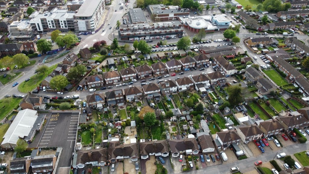
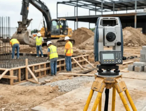
Do you need a plat survey for a new development? Before you divide your property into smaller parcels for development, you’ll need to submit a plat survey to your local government for approval. We’ll explain why this is necessary and how to get a plat survey. With the help of a professional land surveyor, you should be able to get a plat survey reasonably soon.
What’s the Main Purpose of a Survey Plat?
The main purpose of a survey plat is to accurately define the boundaries between different parcels on a property. It provides:
- A clear map of the property parcels
- Access to the parcels
- Easements that may affect the property
Types of Plat Surveys
Depending on how you plan to develop the property will determine the type of plat survey:
- Subdivision: A plat of subdivision divides a larger property into smaller parcels, requiring exact measurements for each division to submit to the local government for approval.
- Consolidation: A plat of consolidation combines several nearby properties into one property. Surveys for each parcel must be submitted for approval to the local government.
- Correction: A correction plat is needed when there are errors or discrepancies in the existing plat for the property.
- Short: A short plat is specific to Washington state, where a property is divided into four or fewer parcels.
- Vacating: A vacating plat legally voids a plat or a portion of it if lots don’t sell or no development has taken place since the original plat survey.
Related Link: What is a Phase 2 Environmental Site Assessment?
Benefits of a Plat Survey
There are several benefits to having a plat survey:
- Gives a detailed, accurate description and illustration of a property
- Designates roads and other access ways
- Defines property boundaries to prevent trespassing and create public access
- Ensures all properties have access to utilities
- Protects your property from being modified or sold by neighboring landowners
- Designates public parcels for parks or emergency shelters
- Outlines where you can legally build or do on each parcel
- Complies with zoning and restrictions
- Helps track residential and commercial properties
- Creates a management system for property development and city growth
What is Included in a Plat Map?
A plat map has to follow all the rules and regulations for your county. While this can differ somewhat from county to county, most plat maps include the following:
- Boundary lines of the property
- Directional position of your property
- Private and public roads
- Easements on or near the property
- Utility lines and other infrastructure on the property
- Environmental features near or on the property
The plat map doesn’t show building structures, driveways, amenities, or fences. It also won’t give specific property dimensions in small units of measurement. It is measured in acres.
When is a Plat Survey Required?
Your local government requires a plat survey when:
- You are subdividing or consolidating the property.
- You are turning the property into public access.
- Someone has been granted an easement on the property.
Who Uses a Plat Survey the Most?
Developers use plat surveys the most because they are usually dividing more significant properties into small parcels for development. Local governments also use the plat surveys to approve any developments or changes to properties in their counties.
How to Get a Plat Survey
To get a plat survey, you simply contact a plat surveyor to create a new plat survey. The surveyor will:
- Research the property
- Take accurate measurements
- Compare the measurements to the property deed
- Designate property corners and boundary lines
- Create a plat map illustrating their findings
If you think a plat survey was done in the past for the property, you could research public records online to see if one already exists. Some counties utilize geographic information systems (GIS), allowing you to view your existing plat map.
You can also request an orignial plat map from the county because they should have a plat map on file, but this might require a trip to the clerk’s office.
Do you need a plat survey for a commercial property? Contact us for plat surveys within the US.
Related Link: Real Estate Development Process
How Many Days Does it Take to Get a Plat Survey?
A professional land surveying company should be able to deliver an accurate plat survey within two to ten business days. Most surveyors can complete a plat survey within one week.
This timeframe can be affected by technician availability, location, accessibility of the property, and size of the property. Most surveyors can complete a plat survey within one week.
If you are requesting an existing plat survey, you may be able to access it online within a day or go to your local county clerk’s office to obtain a copy.
Need to schedule a plat survey for a commercial property you’re developing? Contact us for high-quality, accurate plat maps.
Related Link: What is a Draw Inspection?
Plat Surveys are Essential for Large Property Developments
Developers who want to consolidate or divide a property into different parcels will need a plat survey. You can either access the existing plat map for the property or have a land surveyor create a new plat survey for your property.
Plat surveys illustrate accurate parcel boundaries, easements, and access ways to facilitate faster development approval and construction. Millman National Land Service is a full-service vendor for commercial real estate transactions. We offer a variety of land surveys that meet ALTA/NSPS standards and specifications.
Related Link: Commercial Real Estate Investing: Getting Started


