
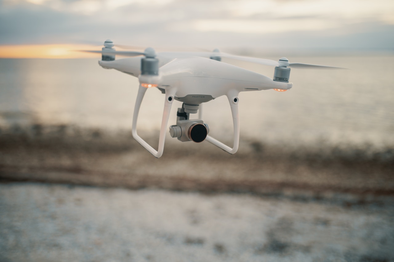
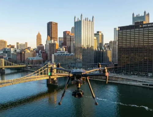
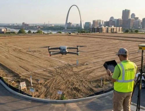
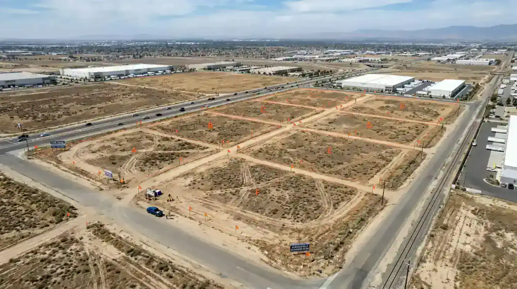
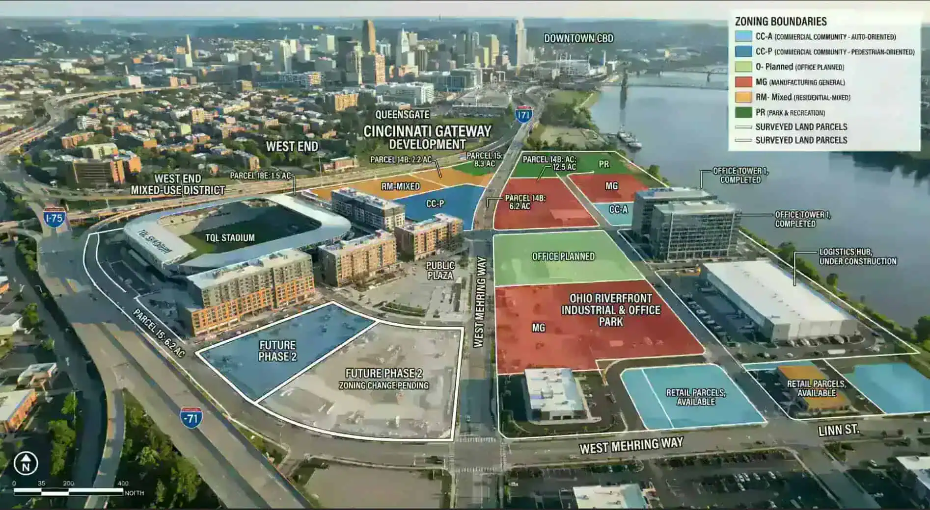
Drones are powerful tools to help in the mapping and surveying industry. They can effectively perform work for 3D mapping, land surveys, photogrammetry, and topographic surveying by flying above the ground. Whether you are looking to add another tool to your services or want to learn more about the world of drones, here is everything that you need to know about drone surveying.
What Is A Drone Survey?
In general, surveying is the science of determining the distances and positions between two points, whether in a 2D or 3D space. This information is used to help make critical decisions about the upkeep of infrastructure, construction site planning, and delineating property boundaries. When you want to complete a drone survey, you take those basic principles but use a drone to gather the information. The drone will fly above the points and record all of that information for you.
Do you need to have a drone inspection for your land or property? Reach out to the experienced team at Millman National Land Services for a consultation!
How Does A Drone Survey Work?
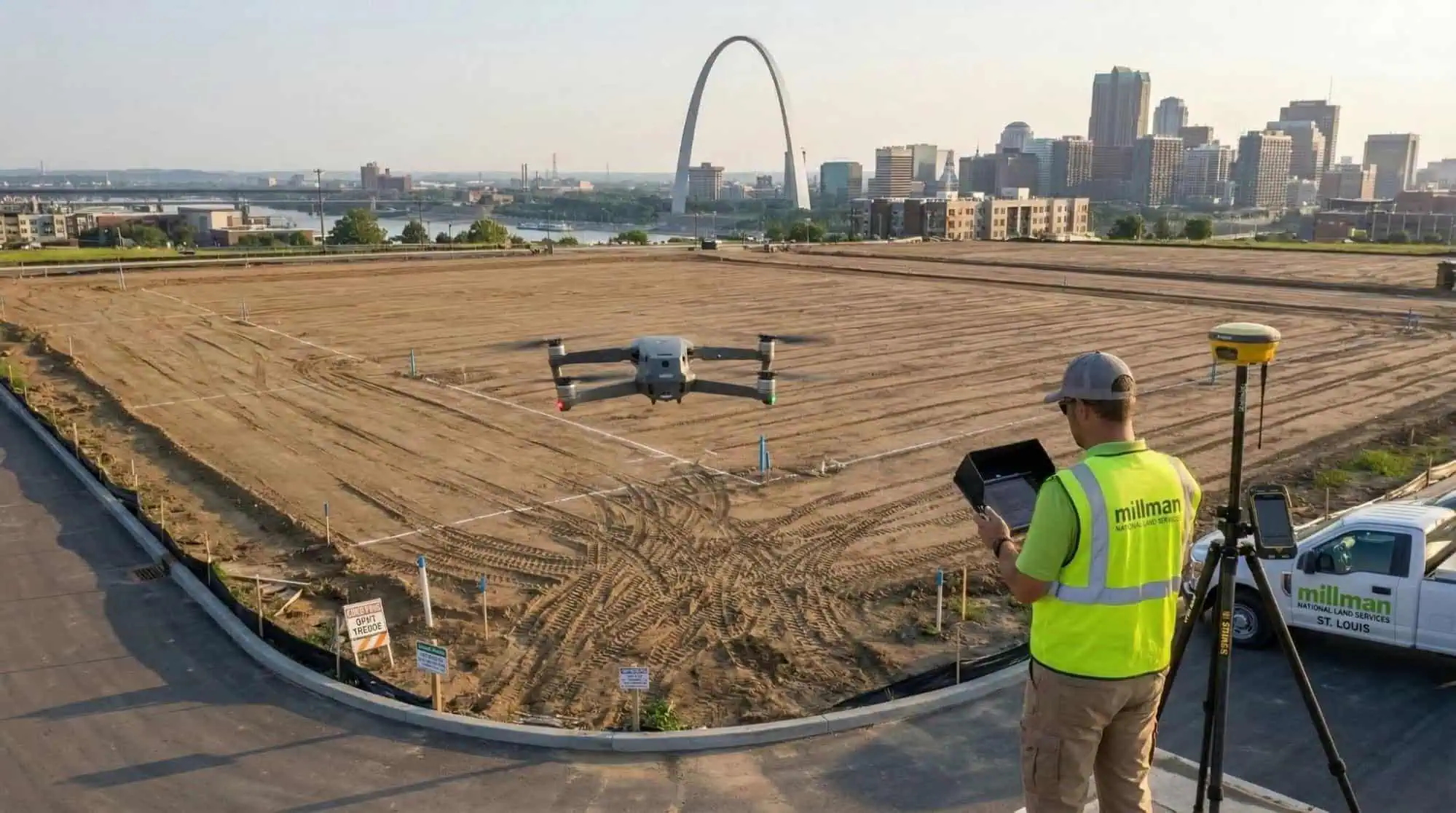
As the drone flies above the ground, it uses downward-facing sensors with multispectral and RGB cameras to capture images. Along with that, many drones feature LiDAR payloads to help collect information. When the drone surveys the lands, it will use the RGB camera to photograph the ground at different angles. Each angle is tagged with the exact coordinates.
Related: When Is an Environmental Site Assessment Needed?
How Do Drones Collect Data?
Drones collect data from the Geographic Information Systems (GSI). They used this information to visualize and map out locations. The GIS is the primary source for collecting data, but other collection tools can be equipped on the drone. In the past, drones were used to capture but not transmit data. All that information had to be retrieved by the operator. With new technology, drones can interrupt data in real-time. You can turn all that raw data into actionable information through GIS technology while the drone is still in the air.
What Drones Are Used for Surveying?
There are plenty of commercial drones on the market. If you are looking for one that can handle surveying, you want to make sure it offers some specific features. Many drones have multirotor, but mapping surveys can benefit from a fixed-wing motor. While multirotor drones are easier to fly, those fixed-wing models will shine when you need them to survey a few hundred acres at a time. Fixed-wing drones glide through the air and stay in the air longer than a multirotor unit.
Since aerial mapping requires you to fly the drone over a space multiple times, you might want to find one that can be programmed for an autonomous flight. If you can’t just activate an autonomous flight, you will have to use software to create a flight path. Once that is done, you can transmit the information into the drone’s remote control for a pre-programmed flight.
As previously mentioned, aerial surveys require you to cover a lot of land. Many drones cannot cover several hectares in a single battery cycle. When you land and deploy your drone several times, it can take precious minutes away from the job. You want to find a commercial model that can fly for at least 30 minutes without interruptions. With that, you can complete the survey without having to swap out batteries.
Aerial surveying relies on photogrammetry to catalog data. This technique uses overlapping geotagged photos to infer the dimension on the ground. For that, your drone needs to have a camera that can capture 4k videos and 12 MP photos for any 3D mapping jobs.
Related: A Complete Guide to Small Cells
Do I Need a Drone Survey?
You might be wondering if a drone is better than those traditional methods. There are many ways that they are more beneficial. These drones can acquire data at vantage points that are not accessible to humans, especially those areas with challenging terrains. There is no need for human operators to measure points in hazardous locations physically. However, those traditional methods do require pre-planning before reaching the site. When a drone flies over an area, it can capture the same amount of data in a shorter time frame. Drone surveying allows the surveyor to collect data more safely and quickly than those traditional methods. If you are looking for a more efficient way to survey those areas, it might be time to consider using a drone survey.
How Accurate Is a Drone Survey?
If you are concerned about the accuracy of a drone survey, these units are incredibly accurate. In many cases, you can expect drone surveys to come within two centimeters of the actual location. Most drones are even more accurate than those measurements. When you work with a professional drone surveying company, you can expect these types of results. Remember that they have access to better equipment and that always leads to more accurate outcomes. Plus, the kind of drone, quality of the camera, flight height, and ground cover can all influence the survey results.
How Do You Map a Drone?
Many surveyors spend hours planning their flight paths. They want to make sure that all the coordinates and perimeters are accurate for a successful survey. Depending on the drone, all that information will need to be entered into the software system. After that, the operator needs to ensure that buildings or other hazards do not obstruct the flight path. When the coordinates are entered, the drone will take off for its survey. In some cases, the operators can maneuver the drone from a remote control, or the machine could have autonomous control of the flight path.
How Much Does a Survey Drone Cost?
In most instances, a drone survey can cost anywhere between $30 to $120 per acre. However, those costs can vary depending on the type of survey needed to be completed and the amount of time to finish the job.
What Kinds of Deliverables Can You Achieve With Drone Surveying?
Depending on the surveying software and data sensors, a drone can achieve several types of deliverables.
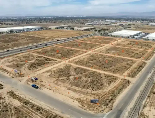
2D Orthomosaic Maps
Many drones specialize in 2D photogrammetry mapping, such as an Orthomosaic map. When the drone flies above the ground, it can capture hundreds of photographs. Those photos are stitched together to create a 2D Orthomosaic map. Each point on the map contains an X/Y axis and color information. These maps feature unformed scales and can be used to measure distances between specific points. Many professionals consider these maps to be an accurate representation of the earth’s geological surface.
ALT-text: a 3D model of North and South America
3D Orthomosaic Maps
Ever since the first maps were created, 2D projection has been a problem. With these 2D images, the image is flattened on the surface, leading to distorted regions on the map. 3D Orthomosaic maps can fix some of those issues. They collect several hundred photos and compile them into a 3D map, which helps to provide better topographic data. In the construction industry, drones work with Building Information Modeling (BIM) software. During each construction process step, a high-resolution 3D map is captured and compared with the BIM objects. This allows for any discrepancies to be identified and resolved.
3D Models
Drones are also effective at collecting data to generate 3D models. These machines work as airborne scanners to capture datasets related to large objects like construction sites and buildings. Once that data is collected, 3D software can create a model for more in-depth site analysis with BIM.
Thermal Maps
The drone imagery from an aerial drone can be used to identify areas with abnormal signatures. The drone inspection can survey complexes, facilities, campuses, cities, and military bases for these thermal images. Hot water lines, supply water mains, supply steam pipes, and condensation return lines can be accurately monitored with the help of a drone survey. When an issue is discovered, leaks can be repaired, saving energy loss in the process.
LiDAR Point Cloud
LiDAR can help a drone to see through trees and ground cover. This process uses lasers to fire at a specific target to see in complete darkness or with obstacles in the way. When the drone is equipped with this software, data is collected to produce a high-density point cloud for the survey site.
Multispectral Map
Another type of data that can be collected is a multispectral map. With that, images capture data within a specific wavelength range on the electromagnetic spectrum. These maps provide better insights to those who need assistance with their crop and agriculture management.
Related: What Is the Purpose of Zoning?
Will Drones Replace Surveyors?
Drones might replace the need for a surveyor to reach a specific location physically. However, drones should be considered another tool in the surveyor’s work bag. These machines are great, but a human will still need to interrupt the information and use it to find solutions to their customers’ needs.
Do you need to schedule a drone survey of your construction site or other property? Millman National Land Service is ready to help!


