Welcome to the world of precise measurements and boundary solutions with the leading land surveyors in Colorado. Whether you’re planning to purchase property, build on existing land, or simply need to confirm the extents of your property, our expert team of surveyors is here to guide you every step of the way. At Millman National Land Services, we combine years of experience with the latest technology to deliver unmatched accuracy and service.
What to Look for in a Colorado Surveyor
When selecting a land surveyor in Colorado, it’s essential to consider their certification, experience, and the technology they use. A qualified surveyor should be licensed in the state of Colorado and have a robust portfolio of successful projects. Look for professionals who utilize modern technology such as GPS and GIS systems, which provide precise data and efficient results. Also, check for responsiveness and the ability to provide clear, understandable explanations of survey results.
How Much Does a Colorado Surveyor Cost?
The cost of land surveying services in Colorado can vary based on the complexity of the project, the size of the land, and the specific services required. Generally, residential property surveys can range from a few hundred to over a thousand dollars. For larger commercial projects, the costs can increase significantly. We recommend requesting a detailed quote from Millman National Land Services to get a clear understanding of the costs for your specific needs.
What Do Colorado Surveyors Do?
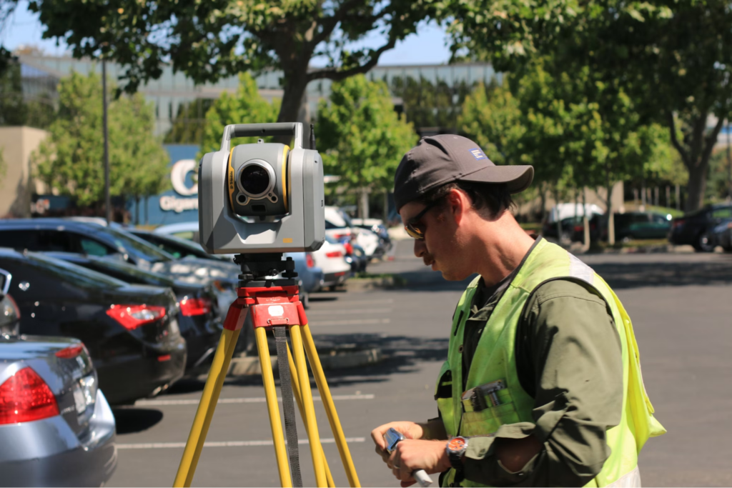
Colorado surveyors perform a range of tasks to determine property boundaries, create maps, and help in the planning and development of land. Services include:
- Boundary Surveys: Determining the exact boundaries of a property.
- Topographic Mapping: Mapping the land’s contours and features, useful for planning and design.
- Site Planning: Assisting in subdivision design and development planning.
- Construction Staking: Guiding the placement of structures during construction to ensure accuracy.
These professionals play a crucial role in ensuring that developments comply with local regulations and codes, preventing legal disputes over land use and boundaries.
Why Choose Millman National Land Services?
Choosing Millman National Land Services means opting for reliability, precision, and top-tier customer service. Our team of expert surveyors brings extensive local knowledge and technical expertise, ensuring that every survey is conducted with the utmost accuracy and legal compliance. We pride ourselves on our innovative approaches and state-of-the-art technology, making us the go-to choice for anyone needing land surveying in Colorado.
Related Blog: Property Line Disputes: What You Need To Know
Frequently Asked Questions
What is a boundary survey?
A boundary survey involves determining the physical boundaries of a property by locating the corners and boundary lines. This type of survey is essential for anyone looking to buy, sell, or develop land.
Do I need a survey before buying property in Colorado?
While not always legally required, getting a survey before purchasing land can prevent numerous potential issues related to boundary disputes and land usage.
How long does a land survey take?
The duration of a land survey depends on the size and complexity of the property. Simple surveys can take a few days, while more involved surveys might take several weeks.
Can a land surveyor tell me what I can build on my property?
Surveyors can provide topographic and boundary surveys that help you understand the limitations set by zoning laws, but specific building compliance should be verified with local planning authorities.
Is a land survey legally binding?
Yes, surveys conducted by licensed professionals are legally binding and can be used as legal documents in disputes or for development approvals.
What technology do surveyors use?
Modern surveyors use a variety of technologies, including GPS, drones, and laser scanning systems, to ensure accurate and efficient outcomes.
How often should I get my property surveyed?
It’s wise to have your property surveyed at the time of purchase and any time you plan significant changes, such as new construction or additions.
What is the difference between a topographic survey and a boundary survey?
A topographic survey maps the natural and man-made features of the land, while a boundary survey determines the exact boundaries of a property.
Do I need a surveyor if I’m installing a fence?
Yes, having a boundary survey done before installing a fence ensures that it is built within your property lines and helps avoid disputes with neighbors.
Can a survey help with flood insurance?
Yes, surveys can determine if your property is in a flood zone, which can impact flood insurance requirements and costs.
What qualifications should a Colorado surveyor have?
Look for a surveyor who is licensed in Colorado and ideally has memberships in relevant professional bodies such as the National Society of Professional Surveyors.
What should I provide to a surveyor?
Providing a copy of your deed and any previous surveys can help expedite the process.
How do I find a good land surveyor in Colorado?
Research local firms, check reviews, and ask for recommendations from professionals in related fields like real estate or construction.
What are the signs of an unprofessional surveyor?
Beware of surveyors who lack clear communication, do not provide detailed contracts, or have a history of disputes.
Why is GPS important in land surveying?
GPS technology increases the accuracy and efficiency of surveys, reducing errors and the time needed to complete the survey process.

