
Land surveying is essential for property transactions, construction projects, and boundary disputes. It ensures property lines are accurately recorded and legally documented. Without a proper survey, disputes and legal issues can arise.
A licensed surveyor in Oklahoma follows state regulations to measure and map land. These professionals use advanced tools and historical records to ensure accuracy. Hiring a surveyor protects your property rights and helps avoid future complications.
Oklahoma Land Surveying Laws
Land surveying in Oklahoma is regulated by the Oklahoma State Board of Licensure for Professional Engineers and Land Surveyors. Surveyors must meet strict education and experience requirements. These laws help ensure accurate property records and prevent boundary conflicts.
Property owners must comply with state and local zoning laws. Some areas have specific regulations regarding property lines and easements. Working with a licensed surveyor ensures your project follows all legal requirements.

Common Types of Land Surveys
Different surveys serve different purposes. Here are some of the most common ones used in Oklahoma:
1. Boundary Surveys
These surveys define property lines and help resolve disputes. They are often required when buying or selling land. Without a boundary survey, ownership conflicts can lead to costly legal battles.
Surveyors use historical records and modern technology to mark accurate boundaries. A recorded boundary survey provides legal proof of property limits. This is especially important when building fences or structures near property lines.
2. ALTA/NSPS Land Title Surveys
These surveys are used for real estate transactions and commercial developments. They provide detailed boundary information, including easements and encroachments. Lenders often require them before approving financing.
An ALTA survey follows national standards to ensure uniformity. It helps buyers, title companies, and lenders confirm that property records match physical boundaries. This reduces the risk of disputes and title issues.
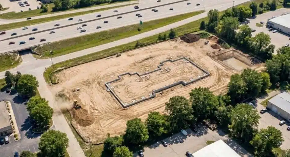
3. Construction Surveys
Construction projects require precise measurements to ensure buildings are placed correctly. These surveys guide the placement of roads, utilities, and structures. Errors in construction surveys can lead to costly delays and compliance issues.
Surveyors provide elevation data, staking points, and layout plans. Engineers and contractors use these reports to align projects with design specifications. Accuracy in construction surveying is key to avoiding future problems.
4. Topographic Surveys
These surveys map natural and man-made features on a property. They are commonly used in planning and development. Engineers rely on topographic surveys for grading, drainage, and infrastructure design.
A topographic survey includes elevation data and terrain details. It helps prevent construction challenges related to uneven land. Developers use these surveys to plan site improvements and road layouts.
5. Subdivision Surveys
These surveys divide larger tracts of land into smaller lots. They are required for new housing developments and commercial properties. Subdivision surveys ensure proper road access and utility placement.
Local zoning laws regulate subdivision surveys. Developers must work with surveyors to meet legal requirements. Proper planning helps prevent land disputes and access issues. Learn more about types of land survey.
Who Pays for a Land Survey?
The cost of a survey depends on the type of transaction and property involved. Buyers usually pay for a survey when purchasing land. Lenders or title companies may also require a new survey before closing a deal.
If a property has undergone changes, such as new structures or land adjustments, a new survey may be necessary. An updated survey ensures property records reflect the current conditions accurately. This is especially important for financing and legal purposes.
Survey costs can also vary based on the complexity of the land and the type of survey required. Rural areas with difficult terrain may require more time and resources. Urban properties may need additional research to confirm legal boundaries.
In some cases, sellers provide previous surveys to save costs. However, if a survey is outdated, buyers may need to commission a new one. Learn more about who pays for a surveyor.
How Much Does a Land Survey Cost in Oklahoma?
Survey costs vary depending on property size, location, and type of survey. A basic boundary survey typically costs between $500 and $1,500. More detailed ALTA surveys can cost $2,000 or more.
Factors such as terrain and research requirements can also impact pricing. It’s a good idea to request multiple quotes before hiring a surveyor. Land survey cost can vary based on location and project complexity.
How to Get a Land Survey in Oklahoma
1. Find a Licensed Surveyor
Look for a surveyor licensed in Oklahoma with experience in your area. Hiring an expert ensures compliance with state laws and accurate results.
2. Provide Property Details
Give the surveyor all necessary information, including property location and intended use. Some projects may require previous survey records or legal descriptions.
3. Get a Cost Estimate
Request a quote based on the type of survey needed. Prices can vary depending on property size and complexity. Comparing estimates can help you find the best value.
4. Schedule the Survey
Once you approve the estimate, the surveyor will visit your property. The process may take a few days to complete, depending on the land size and conditions.
5. Receive the Survey Report
You’ll get a detailed report with property measurements and legal documentation. These records are useful for real estate transactions, construction, or future property planning. Keep a copy for reference, as land surveying plays a key role in maintaining accurate property records.
Why Land Surveys Matter in Oklahoma
Accurate surveys are critical for legal property ownership. They help resolve disputes, ensure compliance with zoning laws, and support real estate transactions. Without a survey, landowners risk legal issues and property conflicts.
Surveying is also important for land development and construction. Engineers rely on precise measurements to plan roads, buildings, and drainage systems. A professional survey ensures everything is properly aligned. Learn more about surveying.
Call to Action
Need a land survey in Oklahoma? Work with licensed professionals who understand state laws. Contact us today to schedule a survey and ensure your property records are accurate.
Conclusion
Hiring a land surveyor in Oklahoma is essential for protecting your property rights. Whether you need a boundary survey, ALTA survey, or construction survey, a professional ensures accuracy. Work with experienced surveyors to prevent legal disputes and property issues.


