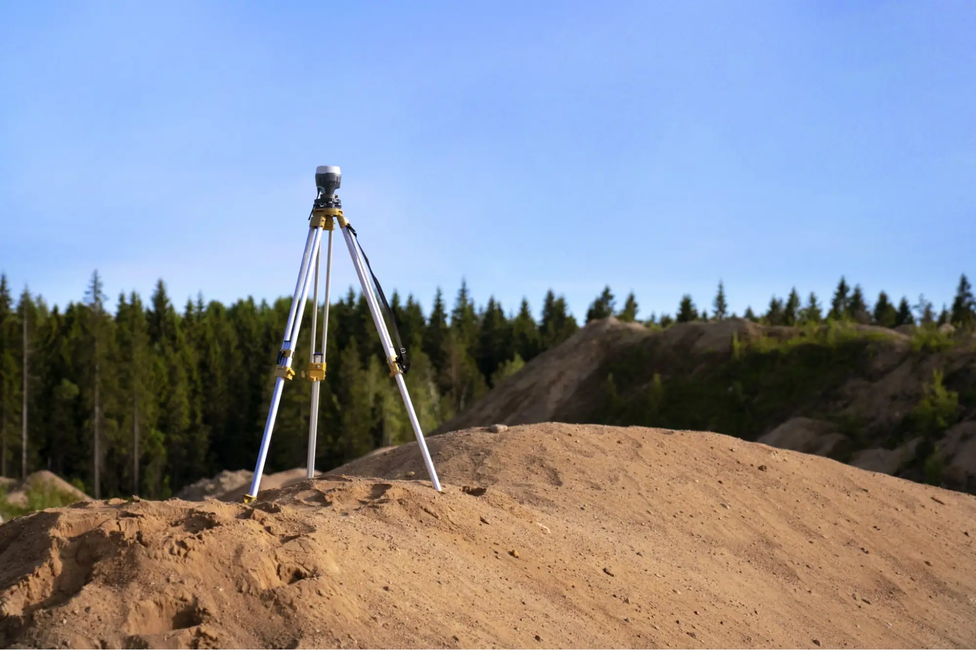
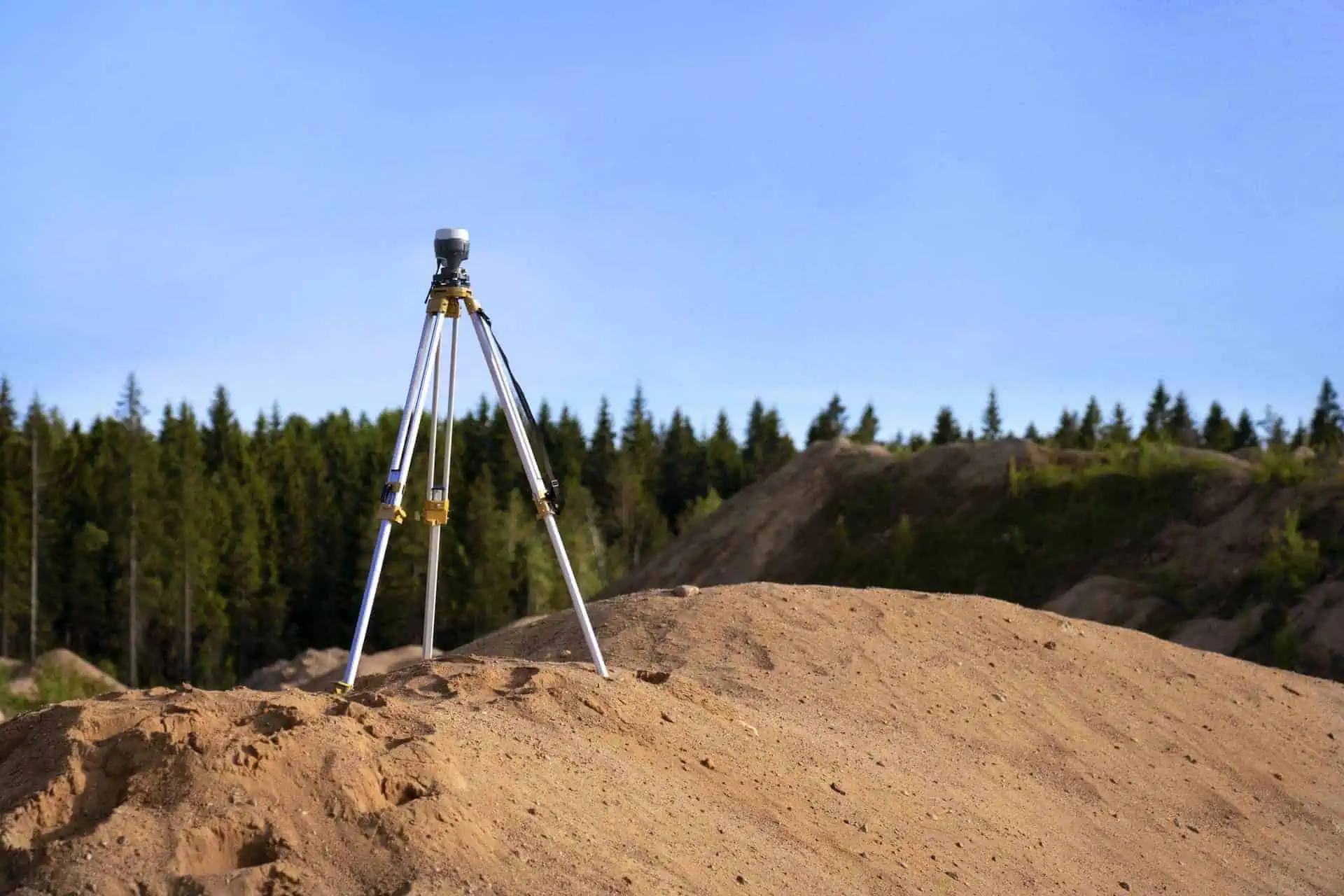
In commercial real estate, due diligence refers to the research and disclosures involved in buying or investing in property. An ALTA Land Title Survey is a key part of that process. Unlike basic boundary or location surveys, ALTA surveys follow strict, standardized requirements that support legal, title, finance, and development decisions.
These surveys represent the highest standards in the industry and are increasingly required by lenders before funding acquisitions or new builds. With decades of experience and a dedicated in-house team, Millman delivers professional survey services across the country.
In this guide, we’ll break down everything you need to know about ALTA land surveys.
Related: Detailed Zoning Reports and ALTA Surveys
National standards set ALTA land surveys apart
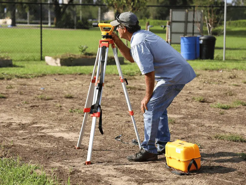
An ALTA land survey begins with an owner commissioning a survey from a qualified land surveyor. One of the fundamental differences between ALTA land surveys and other types of surveys is that ALTA land surveys adhere to national standards known as Minimum Detail Standard Requirements established by both the American Land Title Association and the National Society of Professional Surveyors.
Required and optional survey elements
ALTA surveys include details that help reduce risks like encroachments or missing easements. Required elements listed in the ALTA land survey include:
- Boundary lines, even if hidden by trees, brush, or streams
- Building locations
- Encroachments
- Water features
- Easements, including unrecorded ones
- Utility lines and connection points
- A plat or map with updated boundary info
Optional items are listed in Table A and must be selected by the client. Some, like flood zone classification, are often lender requirements.
After the 2016 update, surveyors no longer provide zoning analysis. To include zoning data in Table A, the client must give the surveyor a report from a certified zoning expert.
Need a zoning report? Millman National Land Services can help
A Primer on the ALTA/NSPS Land Title Survey, Table A
An ALTA/NSPS Land Title Survey provides a base report that has copious detail relating to site boundaries, encroachments, easements, utilities and other salient details with regard to land parcels.
With the 2016 changes enacted for the new ALTA survey, some items, such as the evidence of utilities, have been moved to the base report, but there are still multiple optional items that can be included in the supplementary Table A.
Important Table A items
There are 21 discretionary items, and we will discuss some of the most important.
| Table A Item | Description |
| Item 1 – Monuments | Setting new monuments is optional. This is a minimal cost item that can provide clarity regarding any existing monuments. |
| Item 3 – Flood Zone Classification | It is advisable to select this item to determine whether flood insurance is required. |
| Item 4 – Gross Land Area | For new construction, requesting land area and square footage of improvements is important. This also relates to optional zoning elements in items 6(a) and 6(b) of Table A. |
| Item 6 – Zoning (6a & 6b) | Essential if new construction is planned. If a lender is involved, these items are almost always required. Since the 2016 update, an ALTA surveyor isn’t required to provide a zoning opinion. If these items are requested, the commissioning party must provide a zoning report or letter from an expert. |
| Item 8 – Substantial Features | Refers to property improvements and features outside principal buildings, such as service buildings, sheds, pools, extensive landscaping, and refuse areas. Identifying secondary structures can significantly impact valuation. |
| Item 11 – Location of Utilities | The location of underground utilities and equipment is optional. Evidence of utilities was moved to the base report in 2006, but this item should be included for any survey prior to new construction, similar to zoning items 6(a) and 6(b). |
Related: ALTA Land Survey Process and Overview
ALTA Surveys have strict standards
Compared to basic boundary or as-built surveys, ALTA Surveys must meet strict detail requirements used by attorneys, title professionals, and lenders. The 2016 ALTA/NSPS minimum standard requirements outline what must be included, such as:
- Boundary monuments found during fieldwork
- Rights of way and access points
- Lines of possession and improvements
- On-site buildings
- Easements, cemeteries, and water features
- All visible utilities
- Optional details: zoning, flood zones, parking, height, underground utilities, wetlands, offsite easements
Millman National Land Services offers ALTA Surveys and Zoning Compliance Reports across the U.S., serving REITs, law firms, and developers. We use our own licensed surveyors to ensure accuracy and high standards.
When choosing an ALTA provider, keep in mind: it’s not just the paperwork that matters. The surveyor must also be properly trained and licensed. At Millman, we break down exactly what to look for in a qualified ALTA surveyor.
Need help surveying a land? Millman National Land Service can help
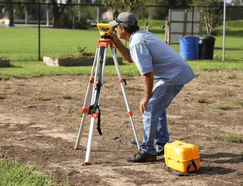
Who is qualified to perform an ALTA land survey?
- A professional land surveyor with a seal and license number is qualified to perform an ALTA land survey.
- Surveys must follow state laws and the national standards set by ALTA.
- They’re often required by lenders and title insurers for acquisitions, development, and refinancing.
- While all ALTA surveys follow strict standards, individual surveyor experience can vary—always check their background.
- Hiring a surveyor familiar with local land use helps identify regional risks early.
Millman National Land Services provides ALTA land surveys and zoning compliance reports nationwide, with an in-house team serving REITs, law firms, and developers.
Related: ALTA/NSPS Land Survey and Wetlands Standards
Who performs ALTA land surveys?
The American Land Title Association (“ALTA) and the National Society of Professional Surveyors (“NSPS”) revised the minimum standards for ALTA/NSPS land title surveys (“ALTA Surveys”) in 2016. An ALTA Survey is, in effect, a combination of a boundary survey, an as-built survey and a title survey. Accepted in all 50 states, an ALTA Survey represents the highest standards in the industry.
Many lenders, attorneys and commercial real estate buyers will only consider using an ALTA Survey for due diligence decisions relating to an acquisition or mortgage on a parcel of land. Only a professional land surveyor can prepare an ALTA Survey.
A professional land surveyor will also strictly adhere to state laws with regard to completing ALTA Surveys. ALTA Surveys are widely considered to be the most detailed and comprehensive form of land survey for the commercial real estate market.
Are all surveyors qualified to perform an ALTA survey?
While many real estate and legal professionals know about ALTA/NSPS land title surveys, fewer understand the rigorous path to becoming a qualified surveyor. ALTA surveyors must complete intensive coursework, a multi-year internship, and pass licensing exams.
To take the NCEES (National Council of Examiners for Engineering and Surveying) fundamentals exam, candidates need a 4-year (or in some cases 2-year) degree with approved coursework. After passing, they must complete a 4-year internship before qualifying for the final licensure exam.
Progress and Classification
After passing the fundamentals exam, a new surveyor is called a surveyor intern or surveyor-in-training. They can’t perform licensed surveyor duties until completing a 4-year internship and passing the final licensing exam.
ALTA Surveys Are Performed by Trained Professionals
Millman National Land can provide you with the best ALTA survey solution
Experience Is Important When Selecting an ALTA Surveyor
Even with high ALTA standards, surveyor experience varies. Choose someone with a strong background in ALTA surveys and commercial real estate. Many local surveyors focus on residential or niche work and may not specialize in ALTA.
Millman National Land Services offers nationwide expertise with local knowledge, thanks to offices across the U.S.
Credentials
Always confirm your surveyor’s credentials before hiring. Titles vary by state and may include:
- Registered Professional Surveyor
- Registered Professional Land Surveyor
- Professional Surveyor
- Professional Land Surveyor
Each state sets its own rules, so make sure your surveyor meets local requirements and keeps up with continuing education.
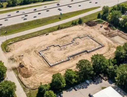
Who Needs to Use ALTA Surveys?
Many different parties can use an ALTA survey for their benefit. Title Insurance companies, attorneys, lenders and developers are the four professional constituencies that are most likely to use a survey.
Broadly used to evaluate an investment in land, an ALTA survey is an essential tool for the design of structure to be built on land, and to validate the viability of a project from the standpoint of a lender.
Related: ALTA Surveys and Appurtenant Easements
ALTA/NSPS Surveys for commercial transactions
A basic boundary survey may be enough if no lender is involved, but when lenders and title companies are part of the deal, they typically require an ALTA Survey.
ALTA Surveys go beyond boundaries; they reveal risks like encroachments, easements, and disputes that public records might miss. These non-recorded risks often pose the biggest threats to property deals.
For lenders and owners, an ALTA Survey is a critical tool for confirming value, zoning, and development plans. Because it follows a national standard, it supports thorough due diligence for any commercial acquisition or project.
Timing for an ALTA Survey
While many lenders will elect to have an owner commission an ALTA Survey prior to funding an acquisition or construction loan, the completed survey is just as important at the end of the project to ensure compliance with applicable zoning laws. Also, having the survey done or revised once a project is complete can ascertain whether there have been any deviations from the engineering or architectural plans.
At Millman National Land Services, we provide ALTA Surveys and other services to ensure that owners, lenders, title companies and attorneys have the confidence that their investments are protected. We invite your inquiries and look forward to serving you with our in-house professional staff.
ALTA Surveys and Appurtenant Easements
The 2016 update to the ALTA/ASCM Minimum Standard Detail Requirements included several clarifications, especially around appurtenant easements.
These easements “run with the land” and can either benefit or burden a property, like when a landlocked parcel uses a neighbor’s land for access (an “easement by necessity”).
Appurtenant easements are part of optional Table A Item 19. They must be disclosed if the title work provided includes them, but clients must specifically request this.
While the 2011 Standards required disclosure of easements tied to improvements and monuments, the 2016 update expanded this to cover all offsite easements that impact the property.
Contact Millman National Land for the best ALTA survey solution
Combining Table A items
When disclosing appurtenant easements in Table A Item 19, you can combine it with other ALTA survey elements for a more complete report. For example:
- Item 1: Place monuments at the corners of the easement.
- Item 8: Show all significant features within the easement, such as signs, pools, landscaped areas, and refuse collection spots.
- Item 11: Mark the locations of above-ground utilities inside the easement.
Combining these items gives a detailed picture of the easement and its important features.
Millman National Land Services performs ALTA/NSPS Land Title Surveys to the highest standards through a dedicated, in-house staff. We invite your inquiries about your specific survey needs.
Since ALTA Surveys are always changing, you must stay on top of the requirements if you want to ensure your survey meets these ever-changing standards. Below, we will outline some of the recent changes to ALTA survey requirements.
Recent Changes to ALTA Survey Requirements
Many of the changes for the new ALTA Survey require additional detail, but the requirements for a surveyor to provide zoning information have actually become less restrictive.
As part of the 2016 new ALTA survey standards, if a client elects to include optional zoning information for Table A item 6, a zoning expert must provide the surveyor with a zoning report or a zoning letter. The most comprehensive type of report is a commercial zoning report, which is something entirely different from a survey.
Detailed zoning reports are vital for land transactions
Surveyors aren’t responsible for zoning advice, but accurate zoning information is critical for any land deal or development.
Detailed zoning reports help confirm land use compliance and are often required by lenders before approving financing. Public records aren’t always reliable. Only qualified land use attorneys or consultants should produce commercial zoning reports.
The changing nature of zoning codes
Assessing zoning for new projects can be complex, particularly since many municipalities continually update their codes, and many districts around the country are now included in special overlay districts that include density bonuses, use restrictions and special requirements relating to parking, mass transit and other ancillary requirements.
Related: A Primer on the ALTA/NSPS Land Title Survey, Table A
Table A and zoning information
If a client provides zoning information to a surveyor, it must be included in Table A item 6 of the report. The zoning information in Table A item 6(a) denotes essential zoning information, including:
- Table of current zoning municipal requirements.
- Copy of current certificate of occupancy.
- Conforming status as provided by the municipality.
- Outstanding violations for zoning, fire and building codes.
- Zoning maps and indication of special overlay districts.
- Zoning designations for neighboring properties.
- Notice of applicable variances/special permits/exceptions/conditions.
- Information relating to setbacks, height restrictions, parking requirements, lot coverage and curb cuts/site circulation.
- Indication of any nonconforming uses.
Item 6(b) requires the surveyor to graphically show setback requirements, but only if a third-party zoning expert provides the data.
If there’s a non-conforming use, lenders often require a damage threshold to limit risk tied to reconstruction or removal for compliance.
To avoid legal issues, a detailed zoning report is strongly recommended when preparing an ALTA/NSPS land title report.
Millman National Land Services offers thorough ALTA/NSPS land surveys and zoning guidance tailored to your project.
ALTA Surveys and Appurtenant Easements
The 2016 ALTA/ASCM Minimum Standard Detail Requirements clarified several areas, including how ALTA surveys handle appurtenant easements.
From the Anglo-French word “apurtenir,” meaning “to belong,” an appurtenant easement stays with the land and may either benefit or burden it. For example, a landlocked lot may rely on a neighbor’s land for access, an “easement by necessity.”
Appurtenant easements, also called offsite easements, are covered in optional Table A, Item 19. Surveyors must disclose them if the title work includes them, but clients must elect to include this option.
Both the 2011 and 2016 Standards require disclosure of their benefits and burdens, but the 2016 update clarified that all offsite easements impacting the property must be noted—not just those tied to improvements or monuments.
Millman National Land Services have experienced staff of urban planners, environmental planners, attorneys, title examiners, surveyors, and researchers.


