There are several reasons why you might want to conduct a land survey. Are land surveys the only type of option available when it comes to solving disputes or planning existing or new developments?
In this article, we’ll be discussing what is a land survey and what other types of surveys are available when it comes to real estate and clearing up confusion in general.
What is a Land Survey?
So what is a land survey? In its most basic terms, it’s a graphic layout of a property. It maps the legal boundaries and other features of a property that might be needed when it comes to solving any issues that might be brought up during real estate transactions. They can be valuable tools to use to clarify any disputes. It’s a way of measuring structures and locating existing features of a property.
If you are experiencing any real estate transactions, contact Millman National Land Services Today!
How are Land Surveys Made?
When it comes to land surveys, they are made from various tools, depending on which one is appropriate. For example, an altimeter would be able to measure a property’s elevation, whereas other tools like GPS that can also prove to be useful when completing a survey.
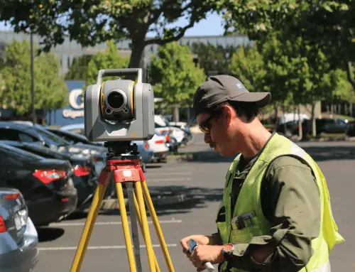
The most common tools used during land surveys are the theodolite, which can help measure horizontal and vertical angles between points. Total stations are also common and ones you’ve liked seen in passing when on your way to work.
Why Get a Land Survey?
Land surveys aren’t always required in a real estate transaction, but they can be useful for solving any issues or ongoing disputes that might occur between the buyer and seller of the property.
Here are some reasons why you might want to get a land survey:
Resolve Boundary Issues
Boundary issues can often be a common reason as to why land surveys are conducted when there are disagreements over where one person’s property begins and ends. It’s important because every square meter can count when it comes to making money on a property as a seller.
Pinpoint Plot Size & Price
With land surveys, being able to know how big a plot size is can help dictate the price of the property. As a result, it can be a great way to negotiate when it comes to buyers who want to try and bargain if the plot is smaller than what’s being listed. It can be a great advantage for individuals who are planning to buy a property.
Build a New Home
If you’re in the position to build your own home, then it’s a good idea to conduct a land survey. It can help find places where you can build the main structure or perhaps establish the location of the drainage system.
Are you building a new home? Contact Millman National Land Survey today!
What to Look For in a Land Survey?
When it comes to getting a land survey, you want it to include the property’s boundaries and any improvements that could be made as a result. Any setbacks and restrictions that the property has will also need to be identified through this survey and whether it’s on a floodplain or not. A land survey should also include a written description that is included within the property deed because not all properties have the visual boundary markers needed.
Related: When to Use an ALTA Survey for an Acquisition or New Project
What Are The Types of Surveys?
- Boundary Survey – A boundary survey includes the boundaries of a specific property, such as the physical markers to define where the boundaries are as well as recorded deeds. It often involves fieldwork in the case of adjoining lands to figure out where one ends and begins.
Typical cost: $450 to $600
- Construction Survey – This type of land survey is often used when sorting out structures such as roads, buildings, and other utilities. There are horizontal and vertical grading that takes place to complete this type of survey.
Typical cost: $1,000 to $1,500
- Location Survey – Similar to a boundary survey, as mentioned above, a location survey has a bit more information added in terms of interior improvements. It is usually used to help adhere to the requirements of loan applications and zoning permits.
Typical cost: $200 to $710
- Site Planning Survey – This is a survey that combines the boundary and topographic survey mentioned further down. It’s often used for designing homes, commercial properties, and industrial sites.
Typical cost: Varies significantly
- Subdivision Survey – When dividing lands into smaller lots or estates, this is the type of survey that’s needed. It can often be a survey for streets and drainage systems as well as lots.
Typical cost: $300 to $400 per lot
- Topographic Survey – This is a typical survey that is used to locate features such as utilities, roads, embankments, and ditches. It’s usually shown as three-dimensional points that feature the property, land features and physical boundary in detail.
Typical cost: $400 to $9,500
- Mortgage Survey – Similar to ALTA surveys, mortgage surveys are most common when someone purchases a home or piece of property. This survey verifies property structures, title owners, and building and zoning codes prior to buying.
Typical cost: $350 to $600
- ALTA Survey – ALTA surveys (or American Land Title Association surveys) provide title companies and lenders required to issue an ALTA insurance policy. We commonly perform these land surveys for those investing in property or buying a new home.
Typical cost: $1,500 to $4,500
Related: ALTA/NSPS Land Survey and Wetlands Standards
How Much Do Land Surveys Cost?
Typically, you can expect to pay $600, on average, for a standard land survey, with prices ranging from $400 to $1,200.
However, this price varies drastically based on the type of land survey, how accessible your property is, and the size of your property.
As acreage increases and property shapes get more unique, the average cost rises. In addition, your property’s location affects survey prices.
Other factors that affect land survey prices include the following:
- Terrain type: The flatter your land, the less expensive the survey.
- Time of year: Challenging weather conditions can lead to higher costs.
- Time: If you need your survey done ASAP, expect to pay more.
Can You Survey Your Own Land?
Yes, but if you survey your own property, you can only use the results for your personal records and not for legal purposes. So hiring professional land surveyors is essential if you want or need to submit the documentation as a legal property record.
If you purchased a property without a survey, you can usually find your boundary lines in the property deed. You can also find any past land survey records by contacting your local county assessor’s office or website.
How Can We Help?
When it comes to looking for the right land surveyor, it’s vital to find the right company, which is where Millman National Land Services comes in the picture. With over twenty years of experience in the industry, you can guarantee nothing, but the best, whether you need one individual to survey or multiple.
Whatever the size of the project is, a successful real estate transaction is not only a dream but a reality, which is why this company exceeds national standards. With innovative management and state-of-the-art technology, you can expect efficiency, consistency, and accuracy for all their services.
Do You Need a Land Survey?
Land surveys are an essential part of a real estate transaction where certain disputes or inquiries require a solution. Whether it’s a commercial building or a new home, it can be handy to have one of these surveys conducted to help solve problems that could delay the process or hinder any opportunities for a successful sale on a property. If you’re looking at getting a land survey, assess what is needed and required so that you can pick the right survey for a specific property or project.
Related: A Primer on the ALTA/NSPS Land Title Survey, Table A


